Table of Contents
Winchester residents took to Facebook on Monday morning after many felt the earth literally moving under their feet.
“Long low rumbling and things in my house shook,” one resident wrote on the Winchester Residents Facebook Page. “Glad you asked so I know I am not imagining it.”
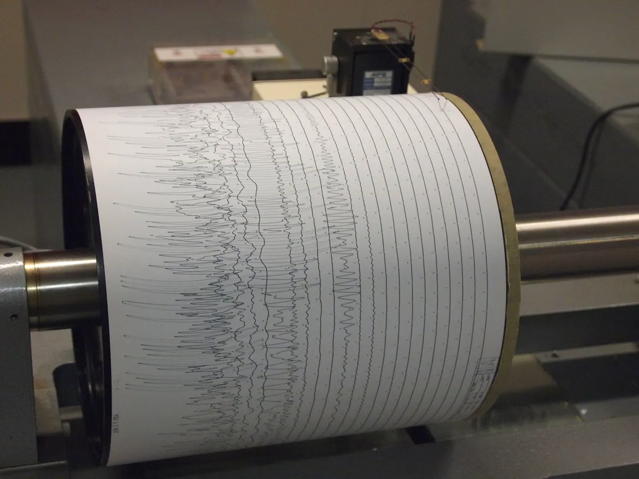
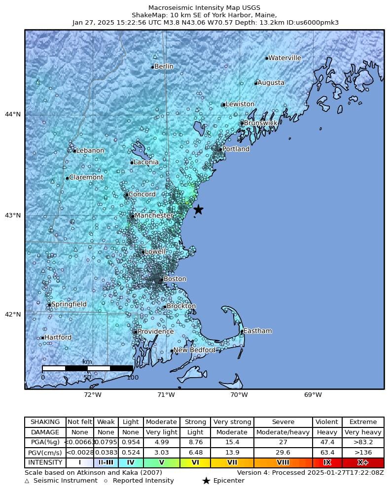
So what was it? The U.S. Geological Survey (USGS) estimated a 4.1 quake 10 kilometers southeast of York Harbor in Maine about 10:22 a.m. The quake was later downgraded to a 3.83.
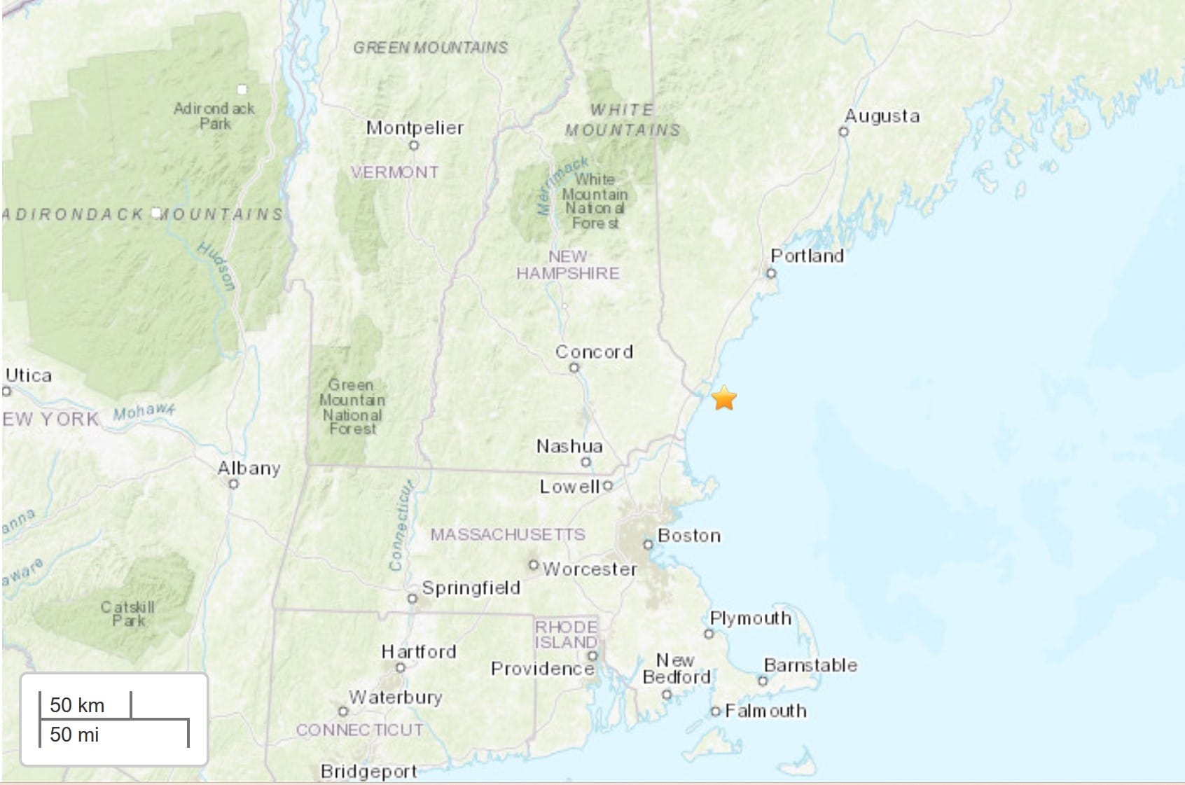
The shaking was felt down as far as Rhode Island and into New Haven, Conn.
The USGS estimated the chances of aftershocks at 13% for another quake of 3.0 or more, 2% for a 4.0 and less than 1% for any quake larger than a 5.0.
This isn’t the first earthquake felt in the area, not even this year. A 1.6 about 2 kilometers south of Henniker, N.H. was felt on Jan. 19. A day earlier, on Jan. 18, a 1.8 was felt 2 kilometers south southwest of Moody, Conn.
Reactions
Winchester residents said when the earthquake hit this morning, they thought it was a low-flying helicopter going over the town.
In other communities, residents didn’t know to react. In West Medford, one resident thought it was her furnace backfiring.
“Here in Billerica, my house was shaking,” one woman said.
Winchester residents were definitely on board with that sentiment.
“I felt the earth, move, under my feet…,” one said, quoting Carole King’s “I Feel the Earth Move.”
Although some said the shaking wasn’t that bad, more of a rumble, one Newbury resident said it was quite strong in her community.
“The house shook, the dog went crazy barking and our small granddaughter ran to me until it stopped after some seconds,” she said.
Some were surprised the quake was felt this far down into Massachusetts. But others said it was “just another day in California.”
History of earthquakes in Massachusetts
If you think the Northeast doesn’t have any major fault lines that cause earthquakes, you’d be wrong.
According to the Northeast States Emergency Consortium (NSEC), there are several, including the Ramapo Fault, a well-known fault zone that runs through New York, New Jersey, and Pennsylvania.
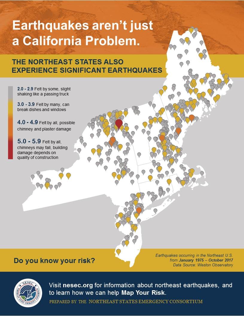
In Massachusetts there’s the Clinton-Newbury fault zone, which “consists of many faults along a line that forms a 97-mile arc that trends from its northeast end near Newbury, Massachusetts on the Atlantic coast southwestward to Clinton and Worcester, and then south into Connecticut.”
The NSEC states that “the historical record of earthquakes in the northeastern United States and adjacent areas goes back to the 1500’s, and a number of seismographs were operating in this region beginning in the early 1900’s. Routine reporting of instrumental data on earthquakes in this region began in the late 1930’s. The number of seismic stations in the Northeast increased significantly between 1970 and 1974. By 1974, area seismologists were operating a regional seismic network in the northeastern United States.”
One of the biggest earthquakes in the state took place on Nov. 18, 1775 at about 4:30 a.m. 30 miles east of Cape Ann. Scientists believe the quake to have been a 6.2 based on reports from as far as Nova Scotia and South Carolina.
“In Boston, the Cape Ann earthquake damaged or destroyed about one third of the chimneys, bent a number of church steeples, and damaged several brick walls,” NSEC history states. “Some streets in Boston were so covered with bricks that they were all but impassible. Damage to chimneys and brick walls was reported at several towns in northeastern Massachusetts, at Portsmouth, N.H. and at Portland, Maine.”

The Cape Ann quake followed an earlier 5.6 shock from Oct. 29, 1727. In 1963, another Cape Ann quake of 4.0 caused some damage and was followed by several smaller aftershocks.
Overall, about “400 earthquakes centered in Massachusetts are known from the earliest reported event on December 19, 1668 in northeastern Massachusetts through 2016,” NESC reports. “Most of the earthquakes have been in the northeastern part of the state, with also a large number of earthquakes centered in the south coast area and Cape Cod. In addition, some earthquakes have occurred in the central part of the state.”