Table of Contents
The Planning Board on Tuesday night voted to finalize which districts make up the minimum required land area to comply with the MBTA Communities Zoning Law, which was enacted in 2021 to remove barriers to development along the transportation network in order to address the state’s housing crisis.
According to Mass.gov, “because some local zoning laws sought to limit or prevent the construction of multifamily housing near MBTA stations, the statute explicitly responds by requiring MBTA Communities to have at least one zoning district of reasonable size in which multifamily housing is allowed ‘as of right.’ This district must generally be located within half a mile of a transit station and allow for development at a minimum gross density of fifteen units per acre. The law also prevents restrictions within the designated district that would interfere with the construction of housing suitable for families with children.”
In Winchester, the minimum required land area is 37 acres and 50% of that land area must be within 1/2 mile radius of the town center train station.
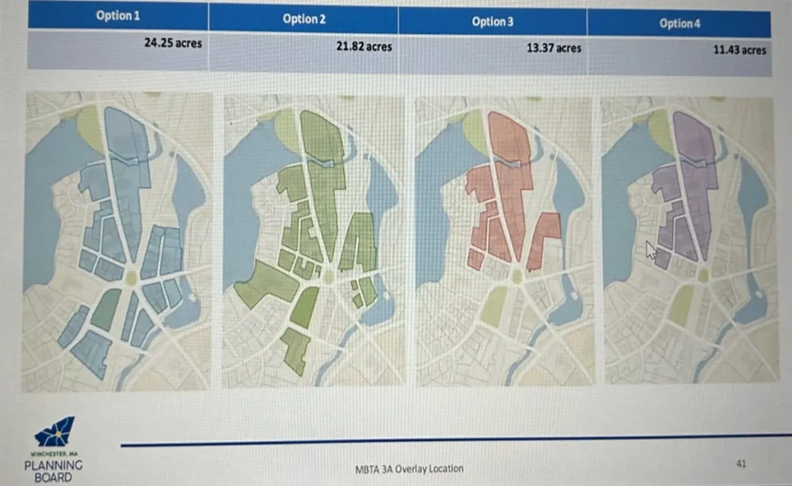
The eight district options presented were the Central Business District (CBD), General Business District 2 (GBD 2), General Business District 3 (GBD 3), Ginn Road, Parkview, North Wedge Pond, St. Mary’s and Mahoney’s/Bonnell.
At its Jan. 9 meeting, the Planning Board voted to include the Parkview and North Wedge Pond districts (the board re-voted the North Wedge Pond district on Tuesday to correct an area miscalculation) and denied inclusion of the Mahoney’s/Bonnell district.
The remaining districts to be considered on Tuesday night were the CBD, GBD 2, GBD 3, Ginn Road and St. Mary’s. The CBD was determined to be a primary location for the overlay due to its prior zoning to encourage mixed-use development and its proximity to transit. The maximum land area in the CBD that the Planning Board considered was 24.25 acres and the minimum land area was 11.43 acres.
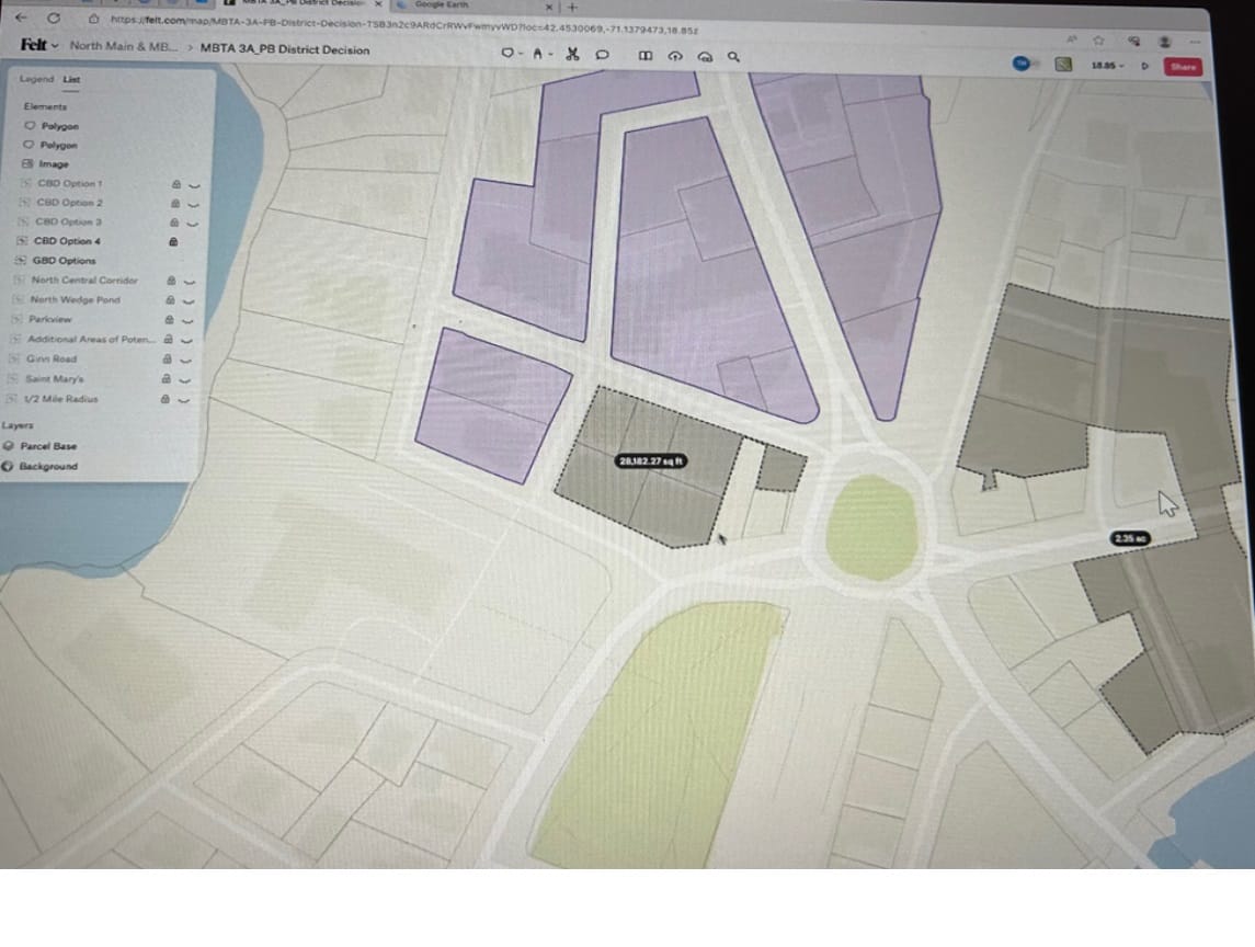
The final overlay included 14.42 acres of the CBD (all within the 1/2 mile of transit). The board voted to include all of the purple area (north core) from option 4. In addition, the board voted to add the gray areas, which were referred to as the Park, Vine, Elm extension and the Shore, Converse, Mt. Vernon addition.
The board also voted to include the green, red and orange sections (of the GBD 2), which comprised 12.41 acres, with 7.5 within the 1/2 mile of transit.
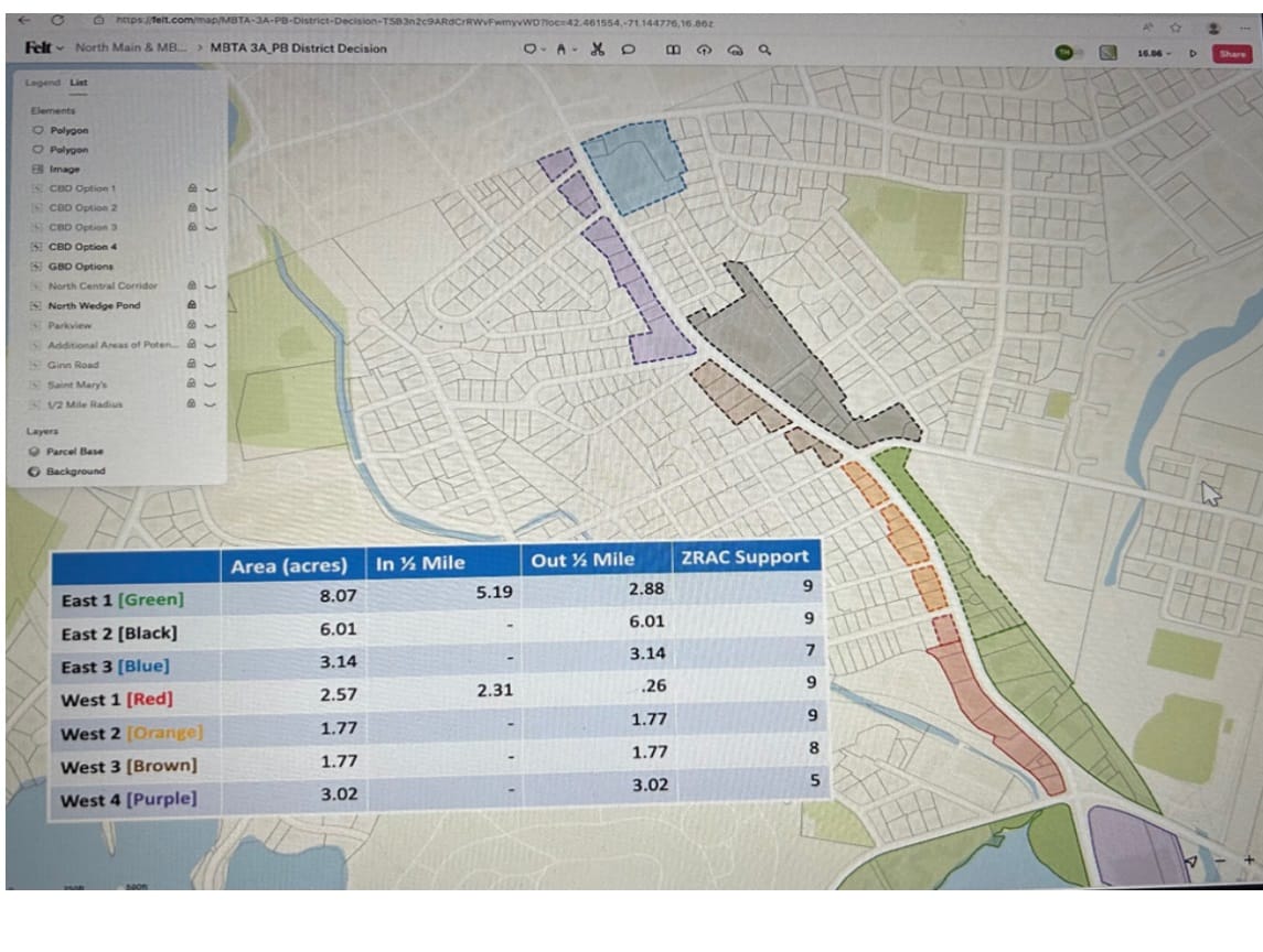
In addition, the North Wedge Pond district provided 7.7 acres with all acreage being within the 1/2 mile and the Parkview district provided 8.7 acres with all acreage falling outside the ½ mile. The total land area established was 42.23 with 29.62 within the 1/2 mile of transit.
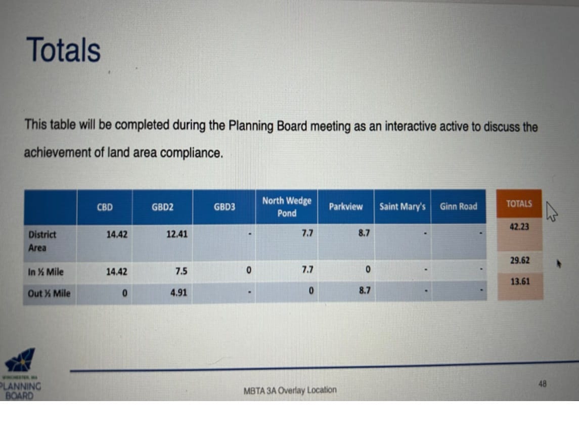
Because it had already met the requirements of 3A, the board decided it didn’t need the GBD 3 (no vote) and then voted to exclude both the St. Mary’s district and the Ginn Road district.
The Planning Board will hold a public meeting on Wednesday, Jan. 24 in person at Town Hall in the Winchester Room at 7 p.m. to present the details on each selected district and to discuss the potential development standards.